

 Saxenian")


Amazon Rainforest Fire Forecasting
Motivation
There are thousands of fires in the Amazon Rainforest that pose a threat to millions of animals and hundreds of indigenous tribes that depend on the Amazon to survive. Lula (President Elect of Brazil) promised during his campaign to fight deforestation, grant protected status to 500,000 square Kilometers of the Amazon, subsidize sustainable farming, and reform the tax code to usher a greener economy. Brazil vowed to halt deforestation by 2030, but in June of 2022 the number of fires in the Amazon hit a 15 year high. The destruction of tropical forests is responsible for approximately 9% of human caused carbon dioxide emissions. Brazil is crucial for discussions on climate change. Its size and the fact that most of the Amazon is Brazilian territory puts Brazil in the spotlight.
Project Goals
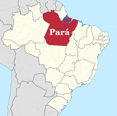
Our project aims to answer 2 questions, focusing on the Brazilian state of Pará:
- Given a recently deforested area, can we predict if a fire will occur there later in the same year?
- Once a fire begins anywhere in the rainforest, can we predict how it will spread?
Data Sources
The same datasets were used to try to tackle both questions. Our fire data came from the NASA Visible Infrared Imaging Radiometer Suite (VIIRS) instrument on the joint NASA/NOAA Suomi National Polar-orbiting Partnership (Suomi NPP) and NOAA-20 satellites. Our deforestation data came from the TerraBrasilis web portal operated by the Instituto Nacional de Pesquisas Espaciais (INPE) in Brazil.
Classification Model
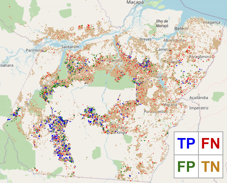
Our approach to the first question was to build a classification model. Using a KNN architecture, we trained our model to predict whether or not a fire would occur in a given deforested area later in the same year. Our model achieved a positive predictive value score (PPV) of 65% and a negative predictive value (NPV) score of 82%. In addition to the value of the model's predictions, it also yielded meaningful clustering results when displayed on a map that could help drive public policy. We saw clustering of post-deforestation fires concentrated around major roads, indicating potential slash-and-burn agriculture in those more accessible areas. We also saw clusters in mostly rural areas where deforestation did not precede fires, seemingly indicating more natural degradation. Lastly, we noticed a distinct absence of deforestation in areas such as indigenous reserves and national parks, indicating the value of these protected lands in combatting the shrinking of the rainforest.
Forecasting Model
We built a forecasting model to attempt to answer the second question. We mapped fire data and deforestation data onto a standardized grid and structured our problem as a next frame video prediction task with one video frame per day. Given a series of 10 days/frames as input, our model attempts to predict the location of fires on the following day. This model utilized a chained convolution LSTM structure implemented in Keras.

The overall performance on this task was evaluated using mean squared error (MSE), structural similarity index measure (SSIM), and peak signal-to-noise ratio (PSNR), with the following results:
| Model Version | MSE | SSIM | PSNR |
|---|---|---|---|
| Baseline Model | 0.042 | 0.334 | 16.09 |
| Final Model | 0.015 | 0.746 | 45.57 |
| Change | -0.027 | 0.412 | 29.48 |
| Change (%) | -64.5% | 123.4% | 183.3% |