
")

")
")


PRESSURE: Real-Time Crisis Navigator
July 22, 2015: A team of consultants from San Francisco is in meeting in a conference room in Gombe, Nigeria. They are installing a call center for pregnant women as part of the effort to reduce infant mortality in the developing world. Suddenly, a man bursts into the room yelling something in the local language. Panic sets in when they make out from the chatter that there has been a bombing at a nearby bus station. Their local hosts scatter concerned about their own loved ones’ safety, leaving them to fend for themselves. What should they do? Duck and cover? Head straight to the airport? What’s really going on out there, and where? Finding yourself in a crisis situation in a dangerous, unfamiliar place can be truly terrifying.
There is a large development community in place in Africa carrying out a myriad of humanitarian programs. There can be tens of thousands of foreign nationals on the ground there on any given day. Acts of terrorism are not the only serious safety concern. Political unrest, disease outbreaks and natural disasters are all not uncommon there. Seven of the ten most dangerous countries in the word are on the African continent. Once an afterthought, travel industry experts confirm that traveler safety there has become a primary concern in the last few years. Several applications have emerged in an attempt to address these risks. Some offer news and alert services, while others focus on location tracking and notification but they all have one thing in common: they are based on information obtained from news outlets or governmental organizations that can lag an actual event by precious minutes or even hours. None of them provide any on-the-ground condition visibility.
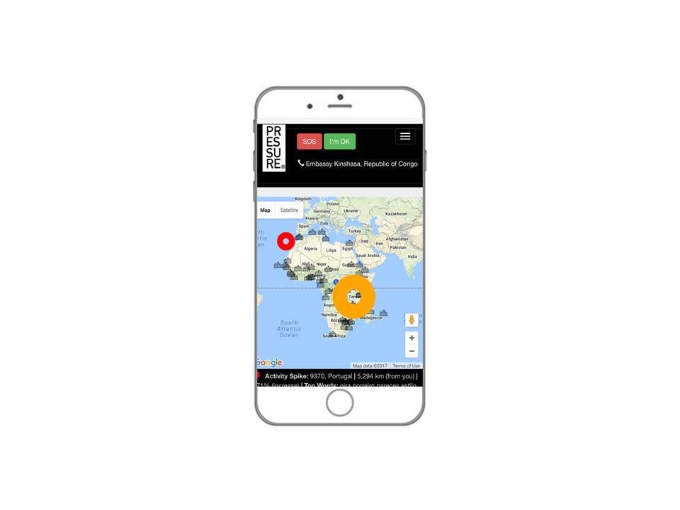
PRESSURE® Real-Time Crisis Navigator is different. Currently implemented as a mobile-optimized web app, it is only real-time application designed for panicked travelers on the ground. The heart of the tool is an early warning system based on Twitter stream. Machine learning algorithms process the Tweets to identify the threat and locate hot spots on the ground. An embedded SOS function instantly notifies emergency contacts and transmits traveler location information at a set interval. Local emergency resource contacts are embedded for instant access and everything is integrated with Google Map navigation functions, making it a truly powerful navigation tool.
Course