

")
")


")


Local Transit Explorer Tool
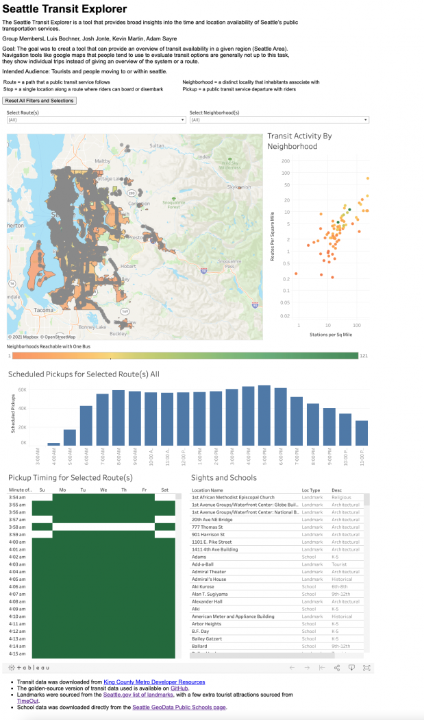
Our project created a tool that can provide an overview of transit availability in a given region (Seattle Area). Navigation tools like google maps that people tend to try to use to evaluate transit options are generally not up to the task, they show individual trips instead of giving an overview of the system or a route. Our tool will be used by tourists and people moving to or within seattle. Firstly, they can select a promising neighbourhood to stay in based on the density of transit options and features like nearby schools and landmarks. Secondly, once they have narrowed their potential list of neighbourhoods, they can easily evaluate transit options to the places that they want to travel to whether that be their downtown office job, their classes at UW or the tourist attractions at seattle center.
Course
More Information
Video
If you require video captions for accessibility and this video does not have captions, click here to request video captioning.